This 40 cm thick matrix- supported diamict surprised the group.
The group looking somewhat surprised.
This 40 cm thick matrix- supported diamict surprised the group.
The group looking somewhat surprised.
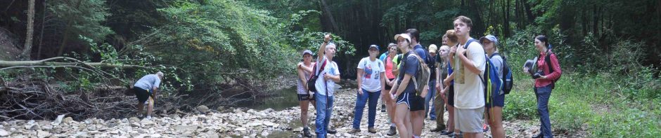
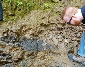
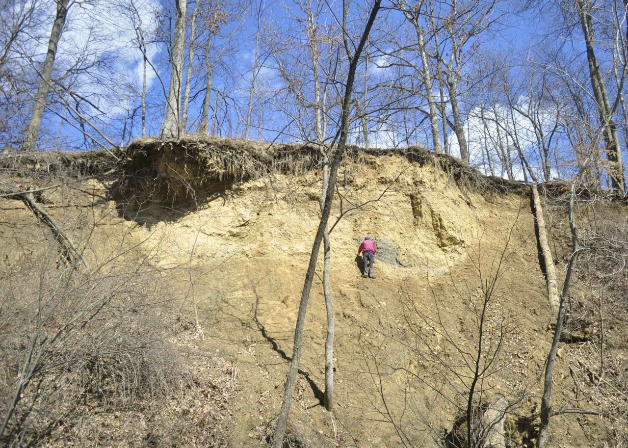
The class stands in front of one of the unconformities in Wooster Memorial Park (aka Spangler). There was some discussion if this is a disconformity (yes) or a nonconformity (maybe yes). The lodgment till at the base is overlain by a fluvial gravel. The high relief of the contact is due to high mineralization – iron, manganese and other oxides; interestingly many of the clasts were coated with over a centimeter-thick rind.
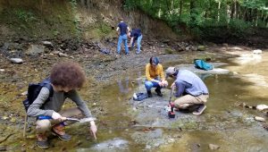
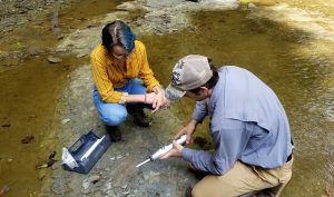
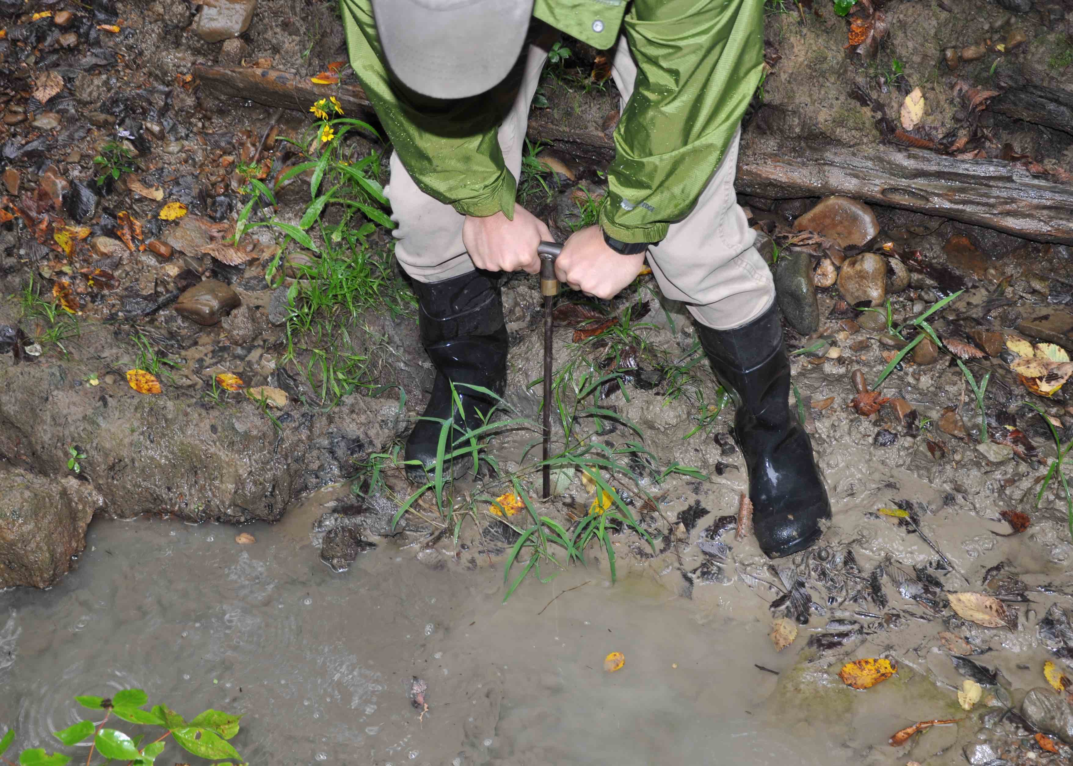
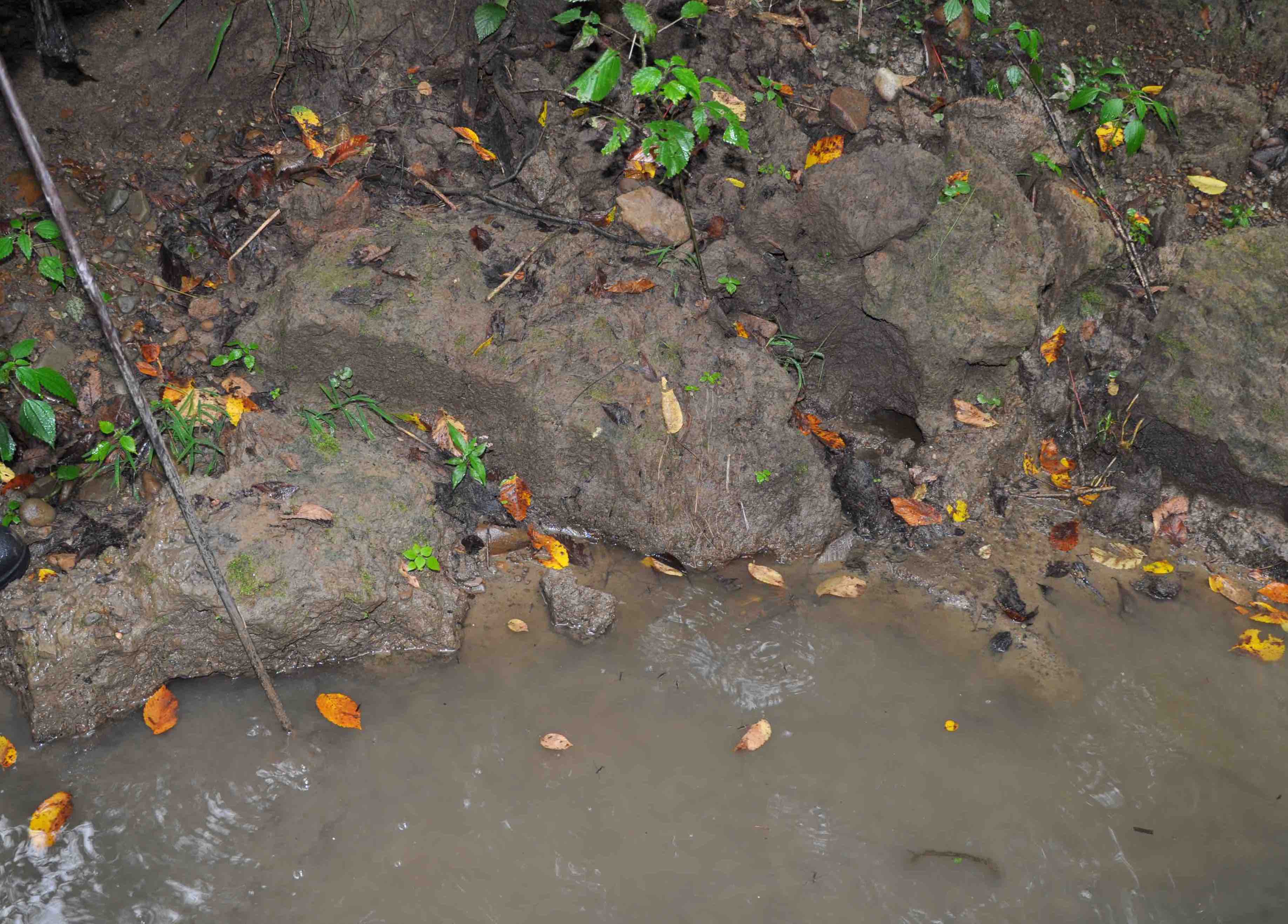
Two class members (in the distance) work on the fluvial sediments sitting on top of the Mississippian bedrock. This is the Great Unconformity in the Spangler Gorge. The Fluvial sediments are capped with mill pond (legacy) sediments. Others drill in stainless steel erosion pins into the bedrock channel. Morgan in the foreground points one of the pins out.
Evan examines a debris flow that moved into the fluvial point bars sediments. He found organics in the flow and we have sent wood samples out for radiocarbon analysis. Results are pending, but they will give us information on the geologic evolution of the gorge.
The Schmidt Hammer is being armed as a way to measure rock strength. Several measurements of the bedrock will be taken to “map out” the relative rock strength of the gorge floor (bedrock stream).
Welcome to the course in Geomorphology. This year we will focus on landscapes around Wooster, Ohio beginning with the LIDAR view of sites and then field visits. A focus will be on reconstructing the geomorphic history with the aim of understanding the role of slope processes, hydrology and soil formation on the once-glaciated, and now fluvially dominated “natural” and built landscapes of the region.
Post, photos, and illustrations by Victoria Race
This semester, the Geomorphology class from the College of Wooster Earth Sciences department went to several local field sites to study geomorphological features, soil catenas, groundwater flow, etc.
One of these sites was Browns Lake Bog, a preserve located near Shreve in Wayne County, Ohio and run by the Nature Conservancy that was established in the 1960’s. College of Wooster students have been involved in several past projects at Browns Lake Bog including tree coring, sediment coringand ice drilling.
It is one of a handful of sites in Ohio which contain an open kettle lake surrounded by a floating sphagnum moss mat (ODNR, 2018). The bog, lake, and hill features here are glacial relicts formed after the last ice age (~20,000 years ago). The preserve is known for its unique boreal plant community which is supported by the special acidic properties sustained by the presence of the sphagnum moss and its insulative capabilities that protect the community from drastic air temperature changes. More than twenty rare plant species can be found hereincluding round-leaved sundew, large cranberry, and grass-pink orchid.

The 2018 Geomorphology class at the entrance to Browns Lake Bog.

The carnivorous Northern Pitcher Plant (Sarracenia purpurea) receives nutrients by trapping insects in its fluid-filled cavities.
The geomorphology class went to Browns Lake Bog to study the glacial features and soil profiles across the preserve. The knolls in the northeast corner and southern part of the property are glacially formed hills called kames. These features form from the collection of sediment on top of the ice during glaciation and are left behind when the ice melts. The open lake at the preserve is known as a kettle lake, a depression also left behind from the glacier. The geomorphology class focused on creating a sediment profile from the top of the kame to the bottom, taking several soil cores to form a soil catena.

Diagram showing the formation of kettle lake and kame features similar to those at Browns Lake Bog.

Soil from sample location at the top of kame.

A sediment core taken at the bottom of the kame showing a dark peat layer and ancient lake sediments.
The cores revealed a high organics content at the bottom of the kame and a deep layer of loess on the top of the kame. Loess is a term used to describe wind-blown sediment that has accumulated over time since the last ice age. The loess cap is thickest at the top of the kame and thins as you move down towards the lake.
Claire Wineman expanded on this soil catena study for her Geomorph project.

Claire at the entrance to the preserve.

Cross section showing general sample locations used in Claire’s study.

Looking up at the kame from the trail.

Soil profile at the top of the kame. Deep loess layer (silty light brown sediment).
Claire took samples from three locations along the kame. One at the top, middle and bottom. The soil pit at Site One (top of kame) was 10 inches wide and 12 inches deep; the soil pit at Site Two (middle of kame) was 13 inches wide and 12 inches deep; and the soil pit at Site Three (bottom of kame) was 16 inches wide and 12 inches deep.
The top of the kame has much lighter soil and a thick loess layer. Sediment at the bottom of the kame was much darker and rich in organics. It had gray lake clays instead of loess. The top of the kame’s loess layer was thicker than the middle showing that that loess cap thins as you move down the hill. Claire reports that the soils at Site One and Site Two at the top and middle of the kame, respectively, largely consist of alfisols and are significantly less acidic and contain far less organic material than Site Three.

Sediment core taken from same location at the top of the kame showing soil profile. Note the thickness of the loess layer which is lighter in color. Claire reported two inches of organic O horizon and ten inches of clay loess B horizon.

Hole dug at the base of the kame. Note the soil darkness which indicates a richness in organics due to the dominance of histosols in the bog and at the base of the kame.

Sediment core taken from same location. Note the dark peat layer at the surface and lake clays towards the bottom. Claire reported a dominant O horizon and portion of lacustrine clay lens.
Her conclusion states, “The soil catena at Brown’s Lake Bog provides another portrait of the geomorphic events that have shaped the landscape over the last 15,000 years. The alfisols and clay loess found on the upper levels of the kame are representative of the weathered sediments once deposited atop the glacier that eventually formed the kame itself; the histosols and lacustrine clay lenses of the lower levels of the kame depict the legacy of kettle lakes and the resulting bog environment. While the Bog’s landscape alone is enough to show us its geomorphological history, its soil catena gives us a perspective on its internal processes, the events that have shaped it since glacial activity, and the events that will continue to shape it into the future.”
Welcome to the 2018 Geomorphology course at The College of Wooster. In the archives to the right (and below) are some posts from previous classes – take a look we will be doing some of these activities. Please check this Syllabus weekly for announcements, readings, assignments and links specific to weekly topics covered in class, labs and fieldtrips. The Preparation Questions page will lead you to thought questions, readings and short exercises that should be completed before each class. See About the Course for evaluation, logistics and expectations.
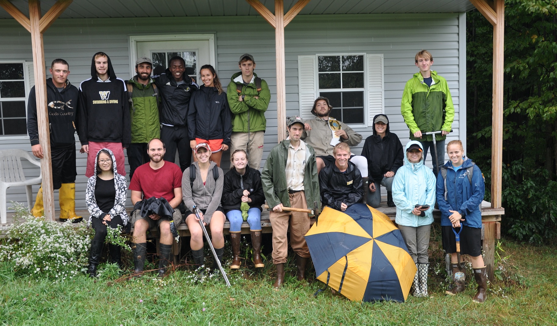
The group at Fern Valley – a bit of a rain during the trip.
Fern Valley is near the southern margin of the Laurentide Ice Sheet.
Peter was able to probe meters down below the glacial moraine materials and into a thick lake clay.
Cantilevers at the toe of the Fern Valley Slump Complex.

Another case of piping within the gravels at the base of a legacy sediment fining upward sequence.