Author Archives: Greg Wiles
Soils at Browns Lake
It is the dry season but even so – we were a bit puzzled why all but one well was dry. We took a quick march to the lake outlet to recover the transducer.
A View of the Killbuck Aquifer in Millersburg
The high wall of Holmesville Supply sand and gravel gave us a look at what the Wooster Aquifer is made – a sand and gravel Ice Age braided stream (special thanks to Jeremiah for his tour of the mining).
Fieldwork in Geomorphology
Geomorphology (Geology 300) has been taking advantage of the good weather this Fall traveling in the area. Above the full class stands on a point bar of the Apple Creek. Waves go out to Brian Merritt who experienced an injury … Continue reading
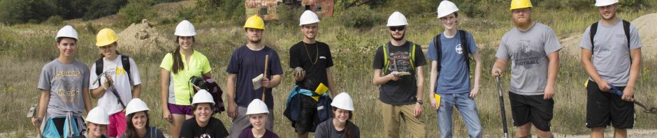
Geomorphology – Fall 2018
Discussing the subsurface flow in a sand and gravel Kame at Browns Lake Bog.
Welcome to Geomorphology and Environmental Hydrogeology
Class meets in Scovel 116 MWF, Lab will meet in various classrooms and labs. Initially we will be visiting local field sites in lab (this coming Monday). Below are some scenes of last year’s class. Surveying the monitoring well elevations. … Continue reading
Fieldwork at Fern Valley and along the Little Killbuck
The group at Fern Valley. Gaging Wilkin Run and measuring water levels in wells. Leo examining the Ice Contact stratified drift of the terminal moraine that in part lies across Fern Valley. This deposit records the Laurentide’s ice sheet advance … Continue reading